Franklin Markers & The Manor Line
Mead Street was also called the Danbury Post Road or the Vermont Post Road in earlier times, as it was part of the longer Post Road that made its way from New York City to Vermont.
A Franklin marker on Route 35, just west of the Mead Street intersection. Click to view larger
Albany Post Road
From New York City, NY to Albany, NY
This historical colonial road was used for mail delivery. It ran along the east side of the Hudson River, a service now performed by U.S. Route 9.
Hudson River Road
From New York City, NY to Albany, NY
This route follows present day U.S. Route 9 to Albany and the Mohawk River Valley. It began as the land route alternative for travel up the Hudson River Valley. The Hudson River Road was only a horse path in the early 1700’s, but became a wagon trail by the 1750’s.
From its beginnings—as Dutch traders came up from New Amsterdam and English colonists came down from Massachusetts Bay—Connecticut’s position between New York and Boston has played an important role in the transportation history of the state and the region. Starting with the establishment of the King’s “best highway” in 1673, three chief routes developed through colonial Connecticut: the upper post road through New Haven, Hartford and Springfield; the lower post road, running east from New Haven to New London and Providence; and the middle route, which ran diagonally across eastern Connecticut from Hartford to Boston. These New York-to-Boston connectors, which we refer to today as I-95, I-91, and I-84, remain the three-pronged spine of overland transportation in Connecticut.
As the Deputy Postmaster of the English colonies, Benjamin Franklin traveled the lower post road through Connecticut in the summer of 1753 with the goal of standardizing postal rates based on distance. Franklin and his assistants drove the road in a carriage equipped with an odometer and placed stone markers at mile points along the route. Soon after, the General Assembly of Connecticut ordered all towns located on any post route to erect stone markers, at least two feet high by the side of the road to indicate the distance to the nearest county seat. Signposts were also erected wherever roads diverged to guide travelers. This concern for milestones and signposts was a clear indication that travel and commerce were on the rise as the population of the colony grew.
The Mead family descend from William Mead of Essex County, England. They had settled in Horseneck, Greenwich, CT. The land that Enoch and Jemima Mead purchased was part of the Great South Lot #10 of the Van Cortlandt Manor) originally purchased from. Lot #10 was the eastern extremity of the Manor, which included most of the land on both sides of Mead Street as far as the North Salem property line. The Manor Line was also called the Twenty Mile Line, since it was twenty miles from the Hudson River and parallel to it. This ancient Manor Line is defined by the north-south portion of Perch Bay Road and the stone wall to the west of the thirteenth fairway of the golf course of the Waccabuc Country Club.
2016 – another mile marker in nearby Cross River, on Mark Mead Road
The Franklin marker in front of the Waccabuc Country Club - compare to the color photo at the bottom of this section
“A Map of Connecticut and Rhode Island, with Long Island Sound, &C.” London: Gentleman’s Magazine, 1776. University of Connecticut Libraries, Map and Geographic Information Center - MAGIC. Click to view full size.
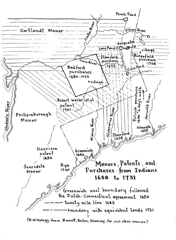
Stephanus Van Cortlandt of the Royal Colony of New York obtained a deed from the Kitchawan Indians in 1699. His manor was extended from the west side of the Hudson to “Kewightequack (Lake Kitchawan) northerly along Peppeneghek (Cross River) then east to the limits of Connecticut, to the river Mutighticus (Titicus). The Delancy map of Manors, Patents and Purchases from Indians shows the east Manor line cutting through Peach Lake in the north, through the center of Waccabuc, then to Cross Pond (Lake Kitchawan).
The surveyors of the Manor Line in 1734 erected a monument, since disappeared, near the southern shore of Lake Waccabuc. One authority claimed the monument was “on the lands of Edwin Bouton”. That could be the E. Bouton whose farm in 1867 was on the present Post Office Road and is now the golf course of the Waccabuc Country Club. They estimated this to be twenty miles from Cortlandt’s Point and it proved to be quite accurate.
An early survey of the Manor Line
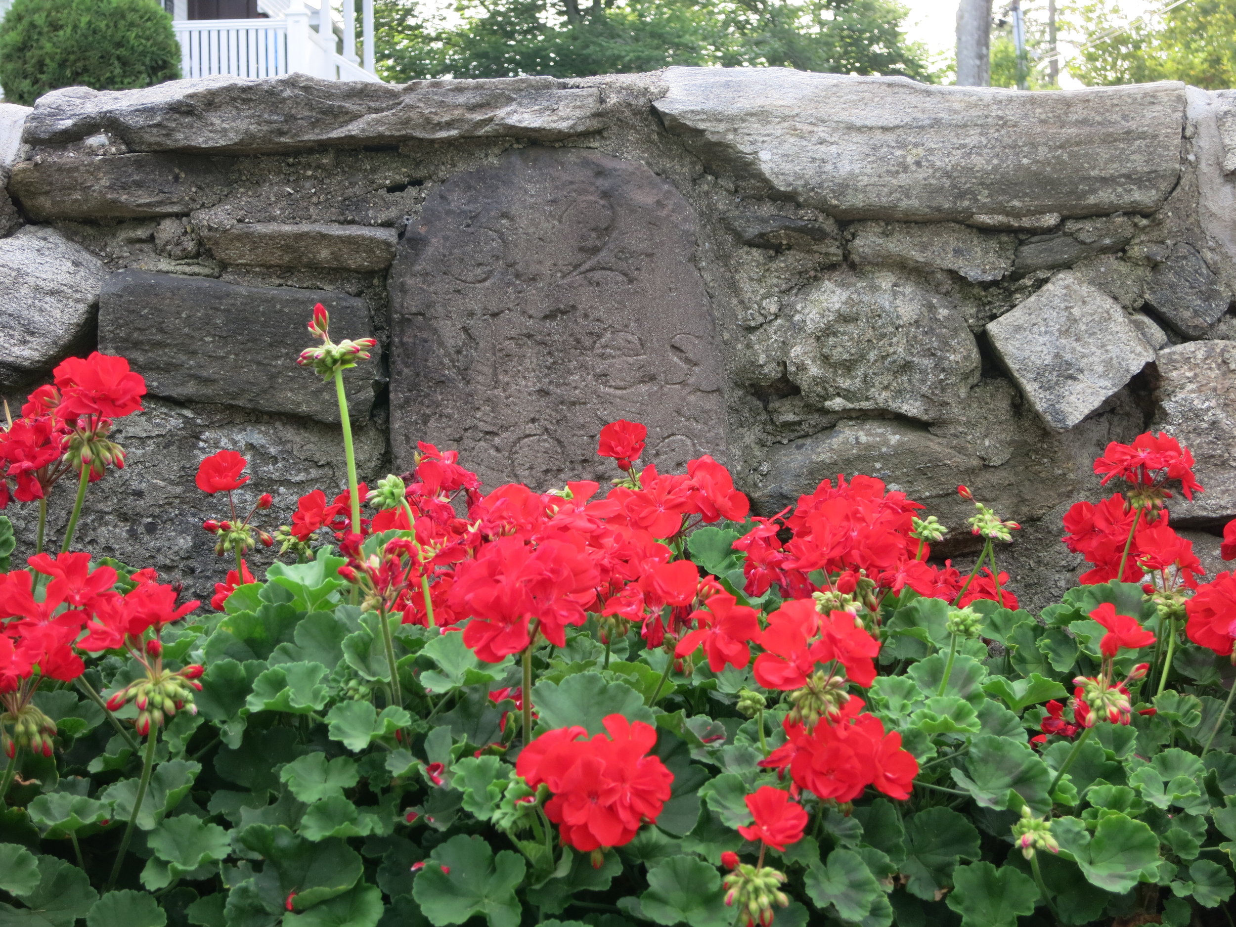
c. 2016 - the Franklin marker in front of the Waccabuc Country Club